1818 Indiana Masonic Map
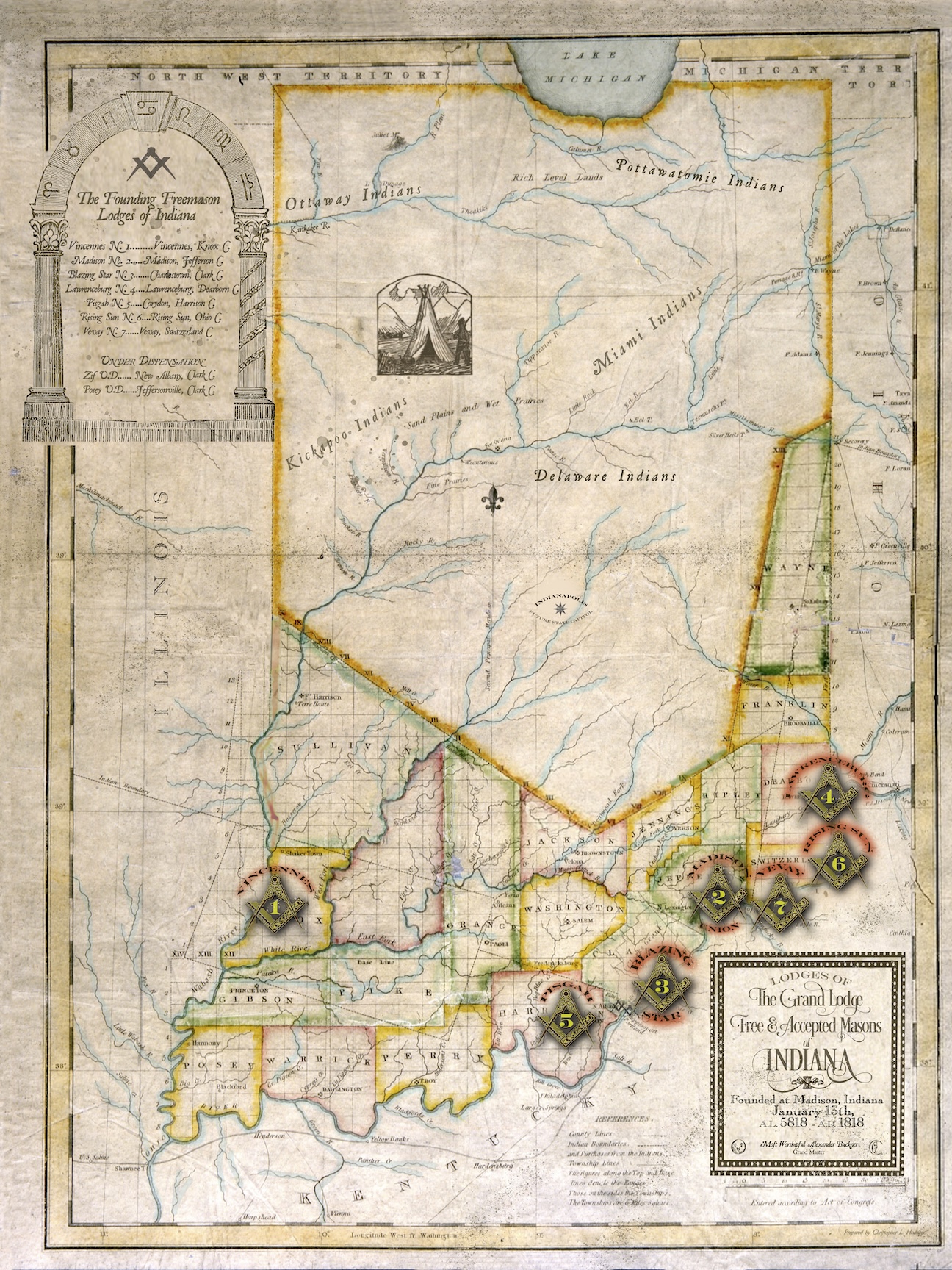
This full-color 1818 map of the original founding Masonic lodges of the Grand Lodge F&AM of Indiana is a period-correct re-creation using the earliest official map issued by the state in 1817. (Note the wrong location of Lake Michigan.) It shows the first seven lodges receiving their charters in January 1818 and the two additional lodges that were under dispensation at that time. Note the vast area of the state that was still mostly populated by Indian tribes, and the original 18 counties. The future capital of Indianapolis was only a dot on the map and dream in the wilderness.
The map measures 18″w x 24″ tall and is shipped rolled in a tube.
$30.00 (plus $15 domestic USPS shipping )
Indiana Masonic History Books

Goodly Heritage: One Hundred Fifty Years of Freemasonry in Indiana, by Dwight L. Smith, PGM
(1968; 535 pages, 48 B&W photos)
ISBN: 978-1-387-81992-8
The most comprehensive historical account ever written about the Freemasonry in the state of Indiana. It was originally published in 1968 in conjunction with the 150th anniversary of the 1818 founding of the Grand Lodge of Indiana F&AM in Madison, and is widely considered to be the most authoritative historical reference work for the state’s fraternity. It contains a wealth of early photographs of historic lodges and influential men within the Masonic community, along with exhaustive reference lists of lodges, grand lodge officers, and more. Long out of print, this facsimile reprint edition was authorized in 2018 in conjunction with the Grand Lodge’s Bicentennial celebration.
$49.99 Hardback edition (plus shipping)

Heritage Endures: Perspectives on Two Hundred Years of Indiana Freemasonry by Christopher L. Hodapp, PM, DLS
(2018; 512 pages)
ISBN: 978-1-5136-2902-5
Commissioned by the Grand Lodge for 2018 and written by the author of Freemasons For Dummies, Heritage Endures is an updated chronicle of the Hoosier state’s unique Masonic history, especially examining the last 50 years, and other important events overlooked in the state’s earlier Masonic histories:
-
- The spread of Freemasonry into the Northwest Territory wilderness
- Indiana’s Freemasons Halls
- The history of Prince Hall Masonry and joint recognition in the Hoosier state
- The breathtaking 150th anniversary celebration of the Grand Lodge of Indiana in 1968
- Indiana Masons and the Ku Klux Klan in the 1920s
- The ebb and flow of Masonry’s membership numbers
- Indiana’s E-Masonry pioneers
- Signposts of Indiana’s Masonic history – a guide to the state’s Masonic markers
- Plus historical charts of the more than 770 lodges chartered in Indiana; Past grand Masters; and Past Grand Secretaries